Saturday, June 30, 2012

June 30 - Day 70 - Back to basics

From Sonora Pass (Mile 1018.5) to campsite along East Fork Carson River (approx Mile 1024.5)

Total PCT Miles Hiked Today: 6

Pan here.

Getting a ride out of Bridgeport today was difficult, and discouraging. A rodeo in town, and lots of events connected to the town's really RED, white & blue 4th of July celebration (+ the town's sesquicentennial) meant the highway into & out of town was awash in motor homes, camper trailers, pickup trucks packed with camping gear and lugging trailers of dirt bikes, atv's, jet-skis, motor boats - plus hundreds of basic tourists in SUVs. You'd think we would be offered rides aplenty - but this town's culture doesn't really include hikers. ("Recreation" and enjoying nature in many east Sierra towns apparently can often primarily involve either ammunition or a variety of vehicles needing gasoline ... Hikers and cyclists are rare and "odd")


Eventually a section hiker named "Texas" came by ferrying hikers to town from Sonora Pass 35 miles away and stopped to tell us he'd be back to get us after he dropped the hikers off at the motel.

Wow! We'd been standing with our thumbs out for hours - and it was already 3pm. We were so relieved, since we really needed to get some miles started on the trail today.

We chipped in $20 for gas (which, in Bridgeport, goes for $5/gallon) and Texas got us up to the pass where another trail angel - Owl - had a table of fruit, cookies, cake, coolers of Coke and beer, as well as the New York Times. He called his trail magic spot the "Sonora Pass Café." Delightful!

We met up with other thru-hikers resting there - including That Guy, Helicopter, & Texas Chill.


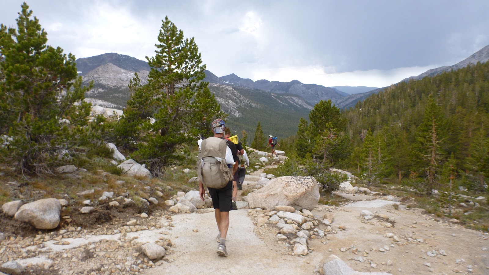
Then we hit the trail - at 4:30 pm. Not much time - and in the next 3.5 days we need to cover 76 miles.

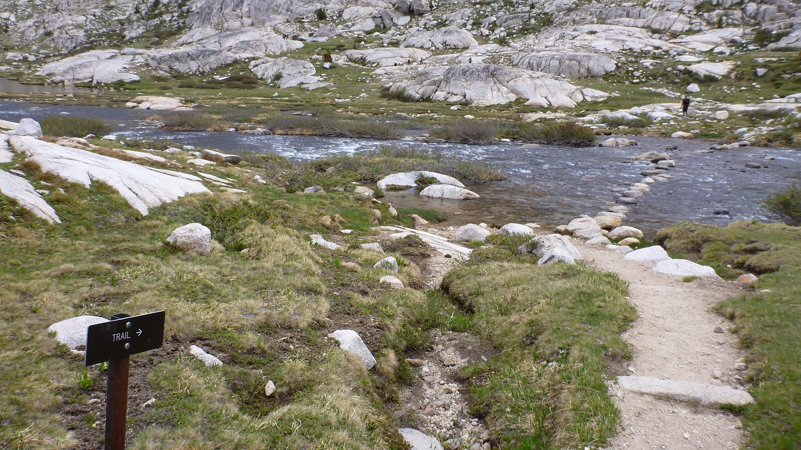
The trail went from the pass (9633 ft) up into the volcanic mountains above 10,500 ft then started descending through the upper valleys of the Carson River drainage. Beautiful day, lovely views, wildflowers, good trail: just what the doctor ordered to ease us back onto the PCT with peace and some rediscovered deep contentment.

We camped in a particularly beautiful glade - the river (still muscular creek size) loud in its rocky bed, hermit thrush ringing down the curtain of the day. We cooked dinner, sipped tequila, and chuckled together at the details of the day. But each of us is grateful to be back on the PCT - and grateful it treated us gently today.

Peace.


- Posted using BlogPress from my iPhone

Friday, June 29, 2012

June 29 - Day 69 - Bridgeport R&R

Zero PCT Miles today.

Pan here. We woke to sunshine on our sleeping bags - a hard, cold night with no one asleep much before midnight meant a little sleep in.


I fixed our coffees from my sleeping bag (us camped in the middle of a dirt road by a scrubby forest meadow). Then we broke camp and packed up. The road below is a remote mountain pass and no cars have passed for some time.

But lo! the first car to come up the road stopped for us: a section-hiker on his way to do Whitney. And he whisked us the 35 miles into town and right to the door of The Ruby Inn, our motel. Angel, indeed.


Here we found boxes waiting that we had shipped to ourselves, and two big soft queen sized beds. It's a shock to us how gloriously and decadently delicious such soft surfaces are. Each time we rediscover them!? Yep.

Breakfast of steak & eggs at the café. Homemade cinnamon roll with shaved almonds and butter. We divided up logistical tasks, got work done, got naps, got more food. Rest!


- Posted using BlogPress from my iPhone

Thursday, June 28, 2012

June 28 - Day 68 - Onto the volcanoes

Wilmer Lake (Mile 987.5) to Sonora Pass (1018.5)

Total PCT Miles Hiked today: 31

We crossed the 1000-mile mark!

Dionysus, Pan, and Seano at the 1000-mile mark ... in mosquito netting.
Dionysus here.

Long distance travelers have often written - in regard to very long expeditions - about what is called "seeing the elephant." Seeing the elephant is the realization of how vast the undertaking of an expedition truly is. The realization is characterized by a feeling of being totally overwhelmed by one's situation. Often it is experienced as a loss of motivation, sometimes it can be paralyzing and/or terrifying; it can even eventually mean the end of the adventure if the traveller can't cope (we've seen this already in other thru hikers -- some who've already lost heart and left the trail). We are in no wise going to quit, but I think it is fair to say we have "seen the elephant."

As I said in yesterday's post the romance of the trip and even the wilderness has faded. We come in to town and no matter how shabby it is or how little the place has to offer, it has become a more difficult to return to the trail.

[**Note: at the moment, as I write this, it is the next day and I am sitting here in the dumpy laundromat of Bridgeport, CA, drying clothes so we can get back on the trail tomorrow morning, and the whole time I'm thinking to myself "I wonder if the room has HBO" ... "maybe the Olympic trials are still on TV". The thought of getting back on the trail tomorrow morning brings little enthusiasm at the moment - daily life with all those ants and mosquitoes (ha!). I look out the window on the Matterhorn wilderness, a ripple of glaciated crags, and I think " yes, it's beautiful, but I don't want to go out there right now". And then I look at the map of the PCT on our Yogi's guide and I see that we are only just past a third of the way done - that we still have 600 miles of Calif to do? and then all of Oregon? and then Washington, too? WHAT?! This is the first time that I have thought that what we are doing is, frankly, insane. So motivation is hard to come by right now. But we don't need motivation to do what we plan to do. Our feelings are beside the point.]

In case you hadn't guessed already, yesterday was a big, painful, tough day. We started in a low basin next to a lake with the most voluminous and persistent mosquito clouds of the trip. (It actually doesn't make sense to talk about them as individual entities, or even as quantifiable colonies or hives like ants or bees; they are a singular annoyance that grows exponentially greater the longer one stays still. So one actually measures mosquitoes in time rather than number - that is, the time from the first mosquito landing to the moment they are so completely at and on you that you've been driven into a kind of restless mild-panic. In the case of Wilmer lake, that took about one second).

So we broke camp and opted to skip what would have been a maddening breakfast, and got rolling early. We made our way up a loooooooong glacial valley to a high pass and a series of lakes. At this point the trail turned round a rocky hillside and dove into a series of beautiful limber pine glades. We turned further west and climbed another not quite as looooooong valley up to the base of a volcanic pumice hillside. Here we had the most unspeakable dinner of the trip. Leftover ingredients combined with hot water and powdered sauces, sheltering from howling winds in scraggly limber pines ... It was hilariously bad, but we needed the carbs to climb the 10,500 foot high ridge of volcanoes ahead.

Then we started up the steep volcanic rock & cinder hill.

You can tell by Dionysus's posture he's having to manage unyielding abdominal muscle pain.
It looks flat, but it ain't. This is a steep slog up the caldera.

Three Gay Caballeros, a shadow of their former selves.

We really love the views, and love the wild craziness of the wind & weather. But we have no love for hiking on volcanic cinders. Ugh.
Seano's shadow on the trail.
It was steep. And at the top the views were amazing. The rounded polished granite range of Yosemite to the south and rows of marching volcanoes to the north. Very dramatic.

A pause at a false summit.


Plus the sun was going down for most of our climb, so we had the slanted shadows of coxcomb ridges against the lower knobs and salmon-rust pools on the horizon. But there's not many places to camp up on sharp volcanic ridgelines. So we hiked ten extra miles (a total of 31 for the day) and an hour and a half in the dark ...


... down the ridge, until we found a campsite that would work.

Amazing and really tough. Phhhh. My pulled groin muscle slowed me down a lot - and Chuck's ankle was very much not pleased. But we made it to the highway, and tomorrow we'll resupply in Bridgeport.

We slept in the middle of a dirt road setting up camp at 10:30 pm.

Completely exhausted (or "knackered" as our Kiwi chums might say).

PS. Pan here. For the record, Seano is the one holding up best among us. Dionysus suffers the hard pain every day. And I am just worn down. But we wake up feeling we've bounced back ...[PS. Never believe the lies your body and your mind tells you when the going gets tough].


- Posted using BlogPress from my iPhone

Wednesday, June 27, 2012

27 June - Day 67 - Into the Hell of Mozzies.

Glaciated granite terrace (Mile 967.5) below Benson Pass to Wilmer Lake (Mile 987.5)

Total PCT Miles Hiked Today: 20

Dionysus here.

Well, we kept hearing about the mosquito hell that awaited us in Yosemite National Park, but they were not as bad as of Tuolumne so we figured yet again we lucked out with perfect conditions this year. (It was a low snow year in the Sierra so passes have been virtually bare of snow and creek crossings that should be burly as all get out are six inches deep). Turns out we weren't THAT lucky. I am composing this post in the tent (oh holiest of sanctuaries!) looking up at the iPhone and in the two inches between the mesh screen of the tent and the sill of the rain cover there are over a hundred mosquitoes whining their neurotic tunes.

Yeah, today was a trying day. It was a conflagration of difficulties of all sorts that tested our resilience. For one, the mozzies. From beginning to end they were dense and persistent. Lots of deet on our legs and arms, yet still a constant aggravation. (I need to learn to simply wear them like some of our fellow hikers have - the bugs only annoying not harmful, after all).

Second, the terrain was really rough. We ascended four different passes doing about 5000 vertical feet in the end. The day was just steep up and steep down with some more fun blowdown action to problem solve along the way.

And then there is the added strain of injury. Pan's foot and my gut keep us slow on the climb and managing pain the whole time.

We did also pass through a ton of beautiful scenery. Smedburg lake in the frost of morning as we warmed our coffee. Kerrick creek (which is usually one of those muscular fords that kicks hikers' butts) was picture worthy with all the blown down trees across the banks. And a late dinner on a glacially polished rock overlooking Wilmer (or Wilma?) Lake at dusk - the tail end of the glamour still bouncing in the breeze. But the romance has greatly diminished with the addition of our new flying friends. Hopefully they will ease up soon or we will acclimate to them; I would hate to pass through Yosemite with little more than the bad taste of mosquitoes in my mouth (no really, I ate two today).

Pan here. Sorry no photos. Skeeters keep driving off the "aww, let's stop and take photos" mood. We just let the suckers chase us as we keep moving.

- Posted using BlogPress from my iPhone

Tuesday, June 26, 2012

26 June - Day 66 - North over pass after pass

Glen Aulin High Sierra Camp (Mile 948.7) to glaciated granite terrace (Mile 967.5) below Benson Pass.

Total PCT Miles Hiked Today: 18.8

Pan here.

• One river ford. No problem (dry foot).
• Lots of blow downs. Pain in the ass.
• Coffee sunrise & tequila sunset (thanks to Dionysus).
• Washed socks & underwear at river.
• Lunch on wooded pass.
• Dinner at wide dry "meadow" sitting on edge of dried creek with thirsty fumbling mosquitoes.

Here we are at dinner time. Seano's the photographer. Mosquitoes are too zippy to be caught on camera. We're suffering from them, but Dionysus's tequila is helping. Coming down the trail behind us is Data (a thru-hiking veteran of the PCT), whom we give a swig of tequila and who would later become a good hiking chum of ours.
Dionysus' gut muscle got sore on the long passes again. My ankle is getting stronger. No trekking poles today.

Seano & Dionysus pick out a granite terrace scoured clean by glaciers, oh, 20,000 years ago or so - with a commanding view of the valley - and all the mountains around sculpted in the same peculiar way: forested pyramids of terraces. Our tent stakes didn't go far here so we jury-rigged anchorage.

Hiding out from moquitoes. What a relief to have the net!! That's solid rock we're camped on. Seano's the photographer.

Mozzies are getting worse and worse. It wears on us to be driven on every time we pause to admire a view, navigate a tricky water crossing, or try to take pictures.. The tents are a relief. Heaven! It seems there is no refuge from everything that wants to snag, bite, sting, chew, or spear us. Except the tent. This is our kid's fort. And it really works!

Every night is a blend of the "lark" of sleeping in the wild, the laughter at its infelicities, and the long hours of toss-and-turn from leg and foot pain. After waking, we soon (more often than not) end up weak with laughter from Seano and Dionysus trading drole observations or commentary on the night.

Tra-la.

- Posted using BlogPress from my iPhone

Monday, June 25, 2012

25 June - Day 65 - Into Yosemite

From Mile 930.1 below Donohue Pass to Glen Aulin High Sierra Camp (Mile 948.7)

Total PCT Miles Hiked Today: 18.6
Total miles today: 20

What a tough night!

Pan here.

The high alpine winds really blew a gale last night. Our little sheltered hollow behind a rock outcropping and a large Limber Pine really didn't protect us as much as we'd hoped. Cold! And the violence of the wind made the trees really roar ridiculously loud - and pushed and shoved on our sleeping bags, reaching icy fingers down into our bags, trying to peel them off us.

Not good sleep for any of us. We kept a bleary eye out for bears (not that any self-respecting black bear would be hanging out at such high altitudes so early in the year). But such gorgeous stars at 10,500 ft -- and what a view come morning. Peaks! Snow-clobbered summits & crags! Reverberating waterfalls! Wow-wow-wow!

We shivered at each exposure to the frosty air as we snuggled in our sleeping bags waiting for coffee (that I was making). And how good the sun felt when it finally arrived - lighting up peaks and snowy slopes all about.

My ankle, Dionysus's gut muscle, and Sean's shins were better, so we sluggishly broke camp and made for the stair step rock work path and bridges twisting and turning down the valley to where it broadened out to a lush meadow running north with a clear serpentine river down its center.

At Tuolumne Meadows store we resupplied for the hike north, then drank Hefeweizen and ate bacon double cheeseburgers (the burgers only $10.75).

Messy mayo & mustard remnants of lunch while at Tuolumne Meadows. That's Scarecrow behind Pan.

Then we headed out toward Glen Aulin High Sierra Camp, north along the PCT. Halfway there, Sean's shoulder strap on his backpack broke! Disaster! But since Sean's mother had supplied us with hefty curved needles, I worked for a couple of hours sitting on the trail sewing the strap back up. (Sure hope my Mama's and my two grandmas' lessons they taught me worked! The end-result looked good (in a Frankenstein way), despite the thread being dental floss!)

Tired, tired as we hiked past crazy huge waterfalls, roaring cataracts, astonishing views of glacier-carved peaks & valleys - and hiked across beautifully built footbridges on lovely and surprisingly well-constructed paths.

When we finally arrived at Glen Aulin, we shoved enough mosquitoes aside to set up camp and cooked a hasty meal next to a campfire other hikers had built.

Done! And boy were we glad to have the mosquito-netted tent back (we hadn't needed it until now and had sent it home early on the PCT).

G'night.


- Posted using BlogPress from my iPhone

Sunday, June 24, 2012

24 June - Day 64 - Peaks & lakes & passes, Oh My!

From campsite near Soda Springs footbridge on Middle Fork of the San Joaquin (Mile 910.6) through the Ansel Adams Wilderness to a tundra meadow below Donohue Pass (Mile 930.6)

Total PCT miles hiked today: 20

From about 7800 ft elevation we hiked up Agnew Pass (9,539 ft) to Island Pass (10,207 ft) to Donohue Pass (11,064 ft).

Hi, Dionysus (Chris) here.

Lots of up today. Three separate passes across twenty miles - and Chuck with a fat sprained ankle and me with a strained groin muscle. Actually though we managed the vertical fine, the hardest part right now is shaking off the dust from five days in town. (The rest surely did us good but now we gotta get our groove back).

Luckily the day was full of beautiful panoramas. Morning greeted us in a low wooded valley with mosquitos and blown down trees. We found our way through hills of lodgepole pine, red fir and hemlock, round a wide grass meadow, and up to the side of a ridge looking out on an impressive set of jagged snowcapped peaks and a string of beautiful mountain lakes.


We popped over Agnew Pass and reconnected with the John Muir Trail at 1000 Island Lake. Took a ton of pictures. Up and over Island Pass. Then down into a high subalpine tundra. Marmots and lots of water from snow melt (this is oddly one of the snowier areas we've seen so far even though it is not very high). Then the gradual rocky climb over Donahue Pass. The view from either side was astonishing. To the south the volcanic peaks around Mammoth and the high Sierra we've come up from. To the north a precipitous drop to a carved green valley full of lakes (and probably more mosquitos - what joy).

Only our second day back on he trail and we don't want to overextend. So we camped as close to the top of the pass as possible.


Subalpine rocks, scree, a few contorted limber pines and icy brooks. High winds up here - so no mosquitos. Bound to be a cold night. But clear and almost no moon so the stars should be great. And tomorrow we reach Tuolumne the gateway to the Yosemite valley. Hopefully another day of great hiking and views.


- Posted using BlogPress from my iPhone

Saturday, June 23, 2012

23 June - Day 63 - The Start of the Second Third

From Mammoth Pass Trail (Mile 904.1) to campsite near footbridge on Middle Fork of the San Joaquin River in the Ansel Adams Wilderness (Mile 910.6)
Total PCT Miles today: 6.5
Total miles today: 12
Sean here. "Sidekick" is out as a trail name since whenever I intro myself, most people think I've said "psychic" or "psycho." I'm going back to Sean until something better comes along.
We got back on the trail today after resting and nursing Pan's swollen ankle and Dionysus's pulled groin for several days at the Motel 6 in Mammoth Lakes. It's a fave landing place for throughers and the laundry room and ice machines see a steady stream of biz. I don't think we realized the toll 11 days in the back country had on us. We were carrying a lot of weight through some tricky terrain and we paid for it physically, emotionally, and psychologically. These three elements are the legs on which any expedition depends and we came into ML wobbling. The support and camaraderie of Calf and Ruby Locks were vital in all of us finally being able to limp off the trail.
ML was very good to us. We all got great massages with Barb at In Touch Spa, and the folks at Mammoth Mountaineering were most, most, MOST helpful in getting Dionysis and me set up with trekking poles. Today, my first day using them, I noticed a significant improvement in my stability and speed. If was a good way to start the second third of this journey.
We passed through the significant tree blow downs around Red's Meadow.

A lot of great women and men have worked long long weeks sawing and moving aside the considerable debris. We met some of them as we hiked through Devil's Postpile National Monument. Thank you!

The mosquitoes are increasing. Beauty and bugs just seem to go together up here.
We stopped early, ate a good dinner, and are in the racks early. It may take a few days to reacquire a healthy, maintainable momentum.
A special shout-out to my folks and sister Kate for having care packages waiting for us at ML. Mom's oatmeal raisin cookies are primo fuel for this next stretch! And what GREAT jerky, Dad!
- Posted using BlogPress from my iPhone

Tuesday, June 19, 2012

19 June - Day 59 - Mammoth Relief

From the campsite at Deer Creek (Mile 901.1) to Mammoth Pass Trail at Lower Crater Meadow (904.1)

Total PCT Miles Hiked Today: 3
Total Miles Hiked Today: 6.5

Pan here.

We hiked into the parking lot and Rubylocks immediately yogi'd us a ride into town! Awesome.

But as soon as we registered at Motel 6, my ankle and foot swelled to surprising size - (I mean even as we stood there!)

Now come a few days of eating and rest, ice & foot elevation. Meanwhile, Dionysus is feeling much less pain - so he appears to be on the mend.

We have passed the 1/3 mark of the PCT. Much logistical work to do here in anticipation of the remaining 2/3.

In honor of Gay Pride, we include this quicky photo of scruffy us trying a joint Joan Crawford head pose (though it's just possible Dionysus is going for a Douglas Fairbanks, Jr. visual quote).

Smooches!


- Posted using BlogPress from my iPhone

Monday, June 18, 2012

18 June - Day 58 - An obstacle course near-marathon of blow downs

From VVR ferry turnoff (877.3) to campsite at Deer Creek (Mile 901.1)

Total PCTMiles Hiked Today: 23.8
Total Miles Today: 25.7

We did not intend this day to be so lonnnng.

We had another great breakfast at VVR then boarded the ferry.

Dionysus sitting next to The Donald on the ferry.


The ferry dropped us off at the eastern end of the lake about 9:30 am.

But now we started increasingly encountering blow downs. Earlier this year a freak storm roared down from the north with hurricane force winds and toppled thousands of mature pines in a large swath of the Sierras.


Today we really had a time making our way around, over, under, between, and through the timber debris. Despite that, Dionysus did quite well with lower pain levels. The rest at VVR apparently did some good.

Then I rolled my ankle badly trying to step around and through the uprooted soil, and the fall sent me on my back down an overhanging boulder above a whitewater creek. Sidekick (Sean) grabbed my hands and pulled me back up. The ankle looked bad.


The sprain had burst the bursa sac, so the fluid swelled the outside of my left ankle. It looked like someone had crammed a small mango under the skin of my ankle. But we tested the ankle right away for range of motion, and the possibility of a break.

No break.

We soaked my foot down in the cold creek while humungous ants crawled on me & mosquitos bit. Ugh.

The ankle could bear weight, and Rubylocks urged me to use her trekking poles - so we continued down the trail with me limping & hobbling. But I got better at managing the loose ankle and soon gave R her poles back.

Now we all wanted to make best time to get to the town of Mammoth Lakes. Our original plan was to hike 15 miles or so then another 13 the next day. Now we concentrated, took no breaks, and wound & wove our way through a landscape increasingly difficult with downed trees. Work crews had clearly been hard at work blazing a way for hikers (& we were very grateful), but the task was Herculean, and much remains to be done.

Around 5:30 pm we came to the last campsite listed on the map for some distance - but the group wanted to push on for a couple more hours. We always had the chance of finding sites not marked on the maps.

As it turned out, no other opportunity presented itself as we hiked across a long mountain slope with stunning views, and on into the night.

We soon had our headlamps on and night-hiked through the tangled blowdowns, across creeks, and up & down mountains. I was so fortunate my ankle held up despite the roots and rocks that caught and jarred my foot. And Dionysus did very well!

We crossed the 900 mile mark about 10 pm.


We hiked rather exhausted into our camp site at 10:30 pm. We quickly set up tents, and collapsed into sleep. Ruby sacked out next to the fire by two hikers who were already asleep there.


- Posted using BlogPress from my iPhone

Sunday, June 17, 2012

17 June - Day 57 - To VVR (Vermillion Valley Resort)

From Campsite along Bear Creek (Mile 871.8) [9,098 ft] to VVR ferry turnoff (877.3)

Total PCT miles today: 5.5
Total miles: 7.2

Pan here.

After coffee, we 3 Caballeros together with Rubylocks & Calf broke camp very early and headed up trail. We left extra early since Dionysus's groin pull was hurting and we knew it might slow us all up. But he didn't complain. Over the hump we started seeing hemlocks - biggies! - growing on the slopes. Wow! These are monsters compared to their eastern cousins. Also red fir and western white pines.

Dirty Brown caught up with us, but he was headed on to Mammoth, and was skipping VVR.

Got to the ferry dock in morning sunlight in about 3.5 hrs. Waited for ferry. All of us were pretty low energy since we skipped brfst.

Other thru-hikers arrived at the dock. Moonwalker, Mark Trail, Stride, etc.

Ferry came zooming along across the bright blue mountain lake. We climbed aboard and were whisked away to the far end of the lake.


Calf showing off his new shades. Seano on the left, and Rubylocks on the right. [Photo courtesy of Stride]


VVR is a haven for thru-hikers, fishermen, and other campers. It's expensive, but remote with generators for electricity, propane tanks for hot water laundry and showers.

We ate a hearty breakfast (steak & eggs) and had delicious Hefeweizen (beer) with it in celebration. Then we got. A five-bed canvas tent cabin booked.

Rest & relaxation, showers, laundry, napping ...

It must be admitted, watching thru-hikers eat is not pretty. It didn't help that the steak was tough. [Photo courtesy of Rubylocks]
Rubylocks, Pan, Calf, and Dionysus playing "Spit" at VVR.
That evening, we had T-bone steak. Mark Trail and Moonwalker joined us all and provided a bottle of wine! Yum. VVR was full of thru-hikers (even though the "pack" -- the preponderance of thru-hikers -- is still behind us on the trail).

Then we played the card game "Spit," drank beer wine and lots of recuperation for Dionysus.

VVR is thronged with thru-hikers.

Good cheer all around.


- Posted using BlogPress from my iPhone

Saturday, June 16, 2012

16 June - Day 56 - Mozzie Mania

From campsite at South Fork San Joaquin River (Mile 852.4) [8,493 ft] over 10,000+ ft. Selden Pass to Campsite along Bear Creek (Mile 871.8) [9,098 ft].

Total PCT Miles Hiked today: 19.4

Pan here.

Very difficult day for Dionysus today. The pain in his lower abdomen increased significantly. So discouraging when it had improved the day before.

With our large group stretched out across a mile or two of trail, we leap-frogged one another, or joined up and hiked together as usual.

Dirty Brown, Seano, Dionysus, Anteater, Calf, Pan, Stride, and Rubylocks. Leaving the John Muir Wilderness.
Dionysus & I cliff jumped about 20 ft into North Sallie Keyes Lake - but the mozzies were bad there and just got worse as we hiked over the pass.

What lakes in view from up there looking north. And how lovely the many braided waters descending the mountain sides to those lakes.

That we had a troop of nine seemed to catch other hikers by surprise (so far we are Calf, Rubylocks, Dirty Brown, Anteater, Geriliet, Stride, & the Gay Caballeros).


Many water crossings today - including one fording of broad Bear Creek. Barefoot. Dirty Brown carried Dionysus's clothes bag; Dionysus was in quite a lot of pain and moving slowly down the mountain. Sidekick/Seano stayed with him. I waited at the crossing and took Dionysus's pack across the creek while he crossed with shoes on. Calf has loaned him the use of his trekking poles since after Glen Pass.

Exhausting day since both Dionysus and I are under-caloried (we under-ate by quite a bit).

When we reached our pine-pillared campsite next to the loud, broad Bear Creek and almost hidden down below the trail, I had Dionysus rest while I set up the tent. Sidekick set up his own and then I made supper sitting in the circle of eight (Gariliet headed off for night-hiking to get closer to Mammoth Lakes).

Plan is to hit the trail at 6 am and get 7 miles to the Lake Edison Ferry trailhead, then down the 1.7 miles to the ferry. We'll then catch the ferry to Vermillion Valley Resort - a camping & hiker outpost high up here in the Sierras. That means a 4:45 wake up! (we want to give Dionysus plenty of time to take it slow & easy so his pain doesn't spike).

Mozzies fill this camp, and our tarp is open to them. But not many come in.

G'night.


- Posted using BlogPress from my iPhone

Friday, June 15, 2012

15 June - Day 55 - Diving into Muir Pass

From Middle Fork Kings River (Mile 831.7) [8,880 ft] to Muir Pass (Mile 838.6) [11,976 ft] to Evolution Creek to campsite at South Fork San Joaquin River (Mile 852.4) [8,493 ft]

Total PCT Miles today: 20.7

Pan (Charles) here. Broke camp to hike out of our copse by the meadow after our customary mocha lattes in "bed" - we all (now nine of us) said good bye to our camp deersies, put all our hands into the circle atop one another and "broke" for the game.


Most everyone in our growing group was up & going up LeConte Canyon along the roaring Middle Fork. Wow! What waterfalls & cascades. Up & up into the tundra toward Muir Pass. (we passed the California halfway point today)!

At broad and alpine 11,600 ft Helen Lake - with a snowy range behind, cerulean waters, and ice floes, Dionysus (Chris) despite his ongoing pain from pulled muscles took off his pack & jumped into the water. Some of our group (& other thru hikers also on the pass) whipped out cameras to take photos of him. He laughed that the water was just too clear & beautiful to pass up. I arrived and agreed, so did as we three Caballeros have always done in alpine waters: took off my clothes and dove in. Twice.

Pan thinking about the plunge into Helen Lake. (Notice that half the lake is still covered in ice?) [Photo courtesy of Rubylocks]

Pan taking the plunge. [Photo courtesy of Rubylocks]

Seano wondering if this is really necessary. [Photo courtesy of Rubylocks]

Seano before the plunge.

Then Seano did (twice), then Dirty Brown (twice). Then Anteater. Couldn't get the women-folk (Rubylocks, Stride, or Nancy) or Calf to do it. Breeze was cold, but sun very warm. 

After visiting the Muir Hut (w/ beehive dome) up at the pass itself, we started down the beautiful lake-dotted alpine landscape on the north side.

Muir Hut atop the pass.
Atop Muir Pass. From the left: Rubylocks, Anteater, Dirty Brown, Dionysus, Pan, Calf, Seano, and Stride. [Photo courtesy of Rubylocks]

At alpine Lake McDermand, Ruby picked a diving rock. Here we stopped for lunch & pretty soon many of us were diving into the waters again - including Calf, Rubylocks, Stride, and Dirty Brown (everyone naked, except Stride who nonetheless gamely jumped in with Ruby). DB dove in w/ his sunglasses still on, and they went to the bottom of the lake. I retrieved them for him in a long deep dive.

Dionysus [Christo]: first dive into Lake McDermand.
Dionysus's second dive into the lake. We always do at least two, since after the first one we know what we're getting into.

Elated, jazzed, and refreshed we continued our hike - the long troop of us - down the valley as thunderclouds formed to one side and another.

The PCT heading down the valley. [Photo courtesy of Rubylocks]

Pan, Calf, Stride, and unknown hiker heading down from the pass. [Photo courtesy of Rubylocks]

Thunder grumbled and we saw the long gray curtains of distant rain raking across other valleys and mountainsides - but we stayed dry.

Really gorgeous descent into valley after valley.

At Evolution Creek we had to do our first ford - wading across the knee-deep/thigh-deep water, then setting up camp about 1.7 miles or so beyond. 

I got a fire going for our many soggy-shod thru-hikers, and we all sat together cooking our various suppers, laughing & chatting about the day. 

- Posted using BlogPress from my iPhone